ARCHITECTURAL
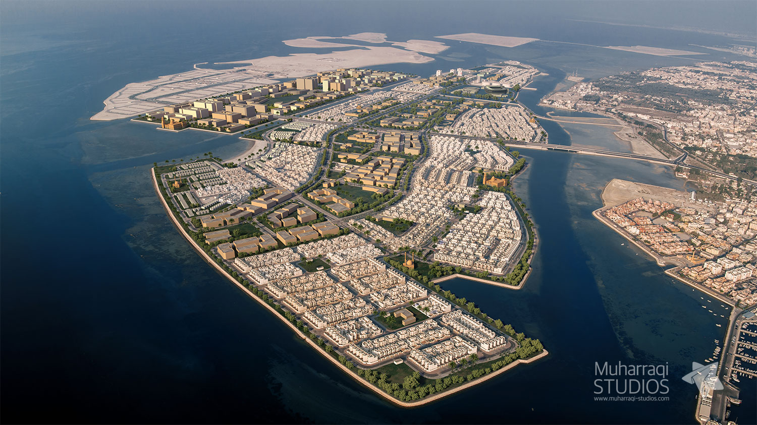
Madinat Salman — Masterplan Visualization
- Client
- Ministry of Housing
- Project
- Madinat Salman
- Location
- Bahrain
- Year
- 2019
- Industry
- Government & Public Sector
- Services
- Masterplan visualization; aerial photomontage and CGI compositing
- What we did
- Built a 3D visualization of the proposed masterplan and integrated it accurately into aerial drone photography of the site captured before construction
About the project
Madinat Salman is a major government-led urban development of reclaimed islands on Bahrain’s northern coastline, commissioned by the Ministry of Housing. Muharraqi Studios did not design the masterplan, the islands or the buildings.
The studio created a 3D visualization of the proposed development and integrated the future masterplan and its buildings into aerial drone photography captured before construction, aligning the CGI to the real photography so the views read as the site would once built.
The result translated the proposed masterplan into realistic aerial views, so that the future development could be assessed at the scale of the entire settlement rather than as isolated buildings, and was used as a high-level presentation and approval tool for senior government officials and the Crown Prince to review the proposed density, building locations and the overall relationship of the development to the existing site.
Outcome
A set of aerial masterplan visualizations prepared for presentation to senior government authorities, supporting the review and approval of the proposed density and building placement before construction.


